
Carte topographique Banisilan
Cliquez sur la carte pour afficher l’altitude.
À propos de cette carte
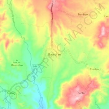
Nom : Carte topographique Banisilan, altitude, relief.
Lieu : Banisilan, North Cotabato, Soccsksargen, Philippines (7.46408 124.65463 7.54408 124.73463)
Altitude moyenne : 392 m
Altitude minimum : 228 m
Altitude maximum : 593 m
Autres cartes topographiques
Cliquez sur une carte pour visualiser sa topographie, son altitude et son relief.
Kidapawan
Located in Kidapawan is the Paniki Falls Eco-River Park located at Umpan Village, Barangay Balabag. Kidapawan is also one of the most well-known starting points for trekking on Mount Apo via the city's Lake Agco in Barangay Ilomavis, Kidapawan-Santa Cruz, and Kidapawan-Magpet trails which towers at 10,311 feet…
Altitude moyenne : 494 m
Magpet
Rice production in Magpet is only 1.16% or 1,028 hectares of the total land area with another 1.50% or 1,115 hectares as potential area due to its land topography, which is mostly hilly or mountainous.
Altitude moyenne : 597 m
Kidapawan
Within the Mt. Apo Natural Park is the Mandarangan Geological Site, which is being promoted as a major educational tourism site. Lake Venado, hidden among the mountain ranges, stands at an elevation of 7,200 feet (2,200 m) above sea level.
Altitude moyenne : 495 m
Kabacan
The landscape is characterized by almost regular landscape of flat terrain. The high mountains and rolling hills leaping close to the river plus the narrow plains have varied topographical features. Other features are moderately sloping and strongly sloping.
Altitude moyenne : 95 m