
Carte topographique Kabacan
Cliquez sur la carte pour afficher l’altitude.
Kabacan
The landscape is characterized by almost regular landscape of flat terrain. The high mountains and rolling hills leaping close to the river plus the narrow plains have varied topographical features. Other features are moderately sloping and strongly sloping.
À propos de cette carte
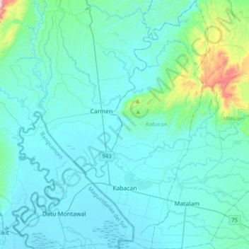
Nom : Carte topographique Kabacan, altitude, relief.
Lieu : Kabacan, North Cotabato, Soccsksargen, 9407, Philippines (7.03385 124.77424 7.34200 124.92876)
Altitude moyenne : 95 m
Altitude minimum : 7 m
Altitude maximum : 924 m
Autres cartes topographiques
Cliquez sur une carte pour visualiser sa topographie, son altitude et son relief.