

Carte topographique Northern Samar
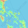
Cliquez sur la carte pour afficher l’altitude.
À propos de cette carte

Nom : Carte topographique Northern Samar, altitude, relief.
Lieu : Northern Samar, Eastern Visayas, Philippines (12.14667 123.89919 12.82943 125.51768)
Altitude moyenne : 42 m
Altitude minimum : -2 m
Altitude maximum : 1.503 m
Autres cartes topographiques
Cliquez sur une carte pour visualiser sa topographie, son altitude et son relief.
Malolos
Malolos is relatively flat of about 0.81% to a gently sloping of 2.17%. The slope of the land descends towards west, southwest to southern direction. The highest land elevation is at about 6.0 meters above sea level while the lowest is only half a meter below sea level. A network of natural waterways and…
Altitude moyenne : 6 m
Bacolod
Bacólod (English: Bacolod), is derived from bakólod (Old Spelling: bacólod), the Old Hiligaynon (Old Ilonggo) (Old Spelling: Ylongo and Ilongo) word for a "hill, turtle, mound, rise, hillock, down, any small eminence or elevation", since the resettlement was founded on a stony, hilly area, now the barangay…
Altitude moyenne : 49 m
Quezon City
Founded as a pueblo by Saint Pedro Bautista in 1590, San Francisco del Monte may be considered Quezon City's oldest district. The original land area of the old town of San Francisco del Monte was approximately2.5 square kilometres (1.0 sq mi) and covered parts of what is currently known as Project 7 and 8 and…
Altitude moyenne : 57 m

San Juan
"San Juan" is a contraction of the city's traditional name of "San Juan del Monte" (lit. 'Saint John of the Mountain'). As with numerous other places in the Philippines, the name combines a patron saint and a toponym; in this case Saint John the Baptist with the locale's hilly terrain and relatively higher…
Altitude moyenne : 35 m

Mandaue
It is one of the two (the other one being the municipality of Consolacion) local government units located within the mainland Metro Cebu where the elevation of land is less than 100 m (330 ft).
Altitude moyenne : 109 m
Mandaluyong
Another claims that the Spaniards named the place based on the report of a navigator named Acapulco, who saw the rolling hills frequently being lashed at by daluyong (“big waves from the sea”). This seems to confirm traditional pre-Hispanic stories that giant waves from the sea would meet the adjoining…
Altitude moyenne : 33 m
Baguio
In 1903, Filipinos, Japanese and Chinese workers were hired to build Kennon Road, the first road directly connecting Baguio with the lowlands of La Union and Pangasinan. Before this, the only road to Benguet was Naguilian Road, and it was largely a horse trail at higher elevations. Camp John Hay was…
Altitude moyenne : 881 m


Lake Sebu
The placid lake of Lake Sebu can be found in Allah Valley near the municipality of Surallah, South Cotabato. Surrounded by rolling hills and mountains covered with thick rain forest, the lake has an area of 361.124 hectares (892.36 acres), with an elevation of approximately 1,000 metres (3,300 ft).
Altitude moyenne : 750 m
Ilagan
Abuan River is the main river of the Northern Sierra Madre Natural Park. It has an average elevation of 82 meters above sea level, and feeds the Abuan watershed in the city. Tourists and visitors can explore the diverse animal and plant life in one of the country’s remaining lush virgin forests. On January…
Altitude moyenne : 123 m




San Juan
"San Juan" is a contraction of the city's traditional name of "San Juan del Monte" (lit. 'Saint John of the Mountain'). As with numerous other places in the Philippines, the name combines a patron saint and a toponym; in this case Saint John the Baptist with the locale's hilly terrain and relatively higher…
Altitude moyenne : 35 m




Legazpi
Legazpi's topography is generally plain on the northeastern areas, with slopes ranging from five to fifteen degrees. The southern areas have mostly rolling to hilly terrain. In the city's coastal areas, the terrain varies from plain (north) to hilly (south). Legazpi is criss-crossed by several rivers including…
Altitude moyenne : 150 m
Marawi
Marawi is located upon the shores of Lake Lanao.[6] It is primarily inhabited by the Maranao people. The city is also called the "summer capital of the south" due to its higher elevation and cooler climate,[7] a nickname it shares with Malaybalay.[8][better source needed]
Altitude moyenne : 707 m



Buhi
Buhi has generally mountainous and hilly surface, with 50% of its area having a slope of around 25%. The Poblacion located on the south shore of Lake Buhi, has gently rolling topography.
Altitude moyenne : 161 m


Santa Maria
The topography of Santa Maria is generally flat, however, it is becoming hilly towards the north. This area covers the barangays of Silangan, Mag-asawang Sapa, Pulong Buhangin and some parts of Balasing with landscape ranging from 8 to 18 percent slope. The rest of the barangays have a slope range from level…
Altitude moyenne : 18 m
Calapan
Philippines > Oriental Mindoro
The overall land characteristic is a wide plain with rivers, interspersed with wetlands at the seacoast periphery. The highest elevation is 187 m (614 ft) above sea level at Bulusan Hill, a 6-kilometre (3.7 mi) long landform east of the city, which interrupts the mostly flat terrain north-east of the…
Altitude moyenne : 40 m

Tagaytay
The southern and eastern portions of Tagaytay are covered by hills and mountains which is generally forests, pine trees and open grasslands. The city lies along Tagaytay Ridge, a ridge stretching about 32 kilometres (20 mi) from Mount Batulao in the west to Mount Sungay in the east with elevations averaging…
Altitude moyenne : 229 m
Surigao City
Philippines > Surigao Del Norte
Surigao City is marked by rolling hills that gently buffers its eastern and western boundaries. To the south-west towers the Kabangkaan Ridge which divides the city from the municipality of San Francisco (formerly Anao-aon). Kinabutan River (otherwise known as Surigao River) meanders Surigao valley before it…
Altitude moyenne : 40 m