
Carte topographique Sison
Cliquez sur la carte pour afficher l’altitude.
À propos de cette carte
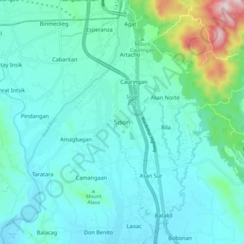
Nom : Carte topographique Sison, altitude, relief.
Lieu : Sison, Pangasinan, Ilocos Region, 2434, Philippines (16.13267 120.46969 16.21267 120.54969)
Altitude moyenne : 124 m
Altitude minimum : 41 m
Altitude maximum : 566 m
Autres cartes topographiques
Cliquez sur une carte pour visualiser sa topographie, son altitude et son relief.
Agno River
The headwaters of Agno River are at the slopes of Mount Data in the Cordillera Mountains at an elevation of 2,090 metres (6,860 ft), where it drains Cretaceous to Paleocene igneous basement rocks, and marine siliciclastic and carbonate rocks. Of its total length, about 90 kilometres (56 mi) runs through…
Altitude moyenne : 521 m
San Nicolas
During the latter part of the 18th century and the beginning of the 19th century, there was a significant migration of Ilocano families to Pangasinan, driven by factors such as rapid population growth and limited land availability for habitation and cultivation. While Ilocano migration to San Nicolas likely…
Altitude moyenne : 397 m
Agno River
The headwaters of Agno River are at the slopes of Mount Data in the Cordillera Mountains at an elevation of 2,090 metres (6,860 ft), where it drains Cretaceous to Paleocene igneous basement rocks, and marine siliciclastic and carbonate rocks. Of its total length, about 90 kilometres (56 mi) runs through…
Altitude moyenne : 521 m
Urdaneta
Rainfall is heaviest in August, which is typically the peak of the rainy season, and lightest in January during the dry period. Humidity remains high year-round due to the city’s low elevation and proximity to coastal air masses, contributing to consistently warm and humid conditions. Humidity remains high…
Altitude moyenne : 29 m