
Carte topographique Singu Township
Carte interactive
Cliquez sur la carte pour afficher l’altitude.
À propos de cette carte
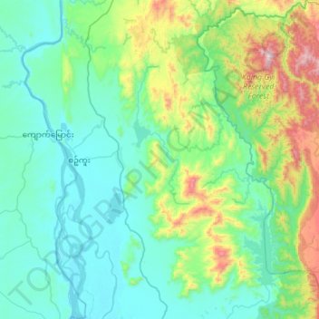
Nom : Carte topographique Singu Township, altitude, relief.
Lieu : Singu Township, Pyin Oo Lwin District, Mandalay, Myanmar (22.29482 95.90011 22.80648 96.33590)
Altitude moyenne : 294 m
Altitude minimum : 63 m
Altitude maximum : 1.339 m
Autres cartes topographiques
Cliquez sur une carte pour visualiser sa topographie, son altitude et son relief.
Myingyan Township
Myingyan Township, Myingyan District, Mandalay, 05251, Myanmar
Altitude moyenne : 107 m