
Carte topographique Mischabeljoch
Carte interactive
Cliquez sur la carte pour afficher l’altitude.
À propos de cette carte
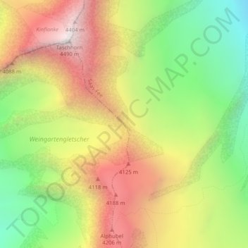
Nom : Carte topographique Mischabeljoch, altitude, relief.
Altitude moyenne : 3.662 m
Altitude minimum : 2.886 m
Altitude maximum : 4.477 m
Autres cartes topographiques
Cliquez sur une carte pour visualiser sa topographie, son altitude et son relief.
Hohlichtgletscher
Hohlichtgletscher, Schaligletscher 2011, Randa, Visp, Wallis, 3928, Schweiz
Altitude moyenne : 3.194 m
Bisgletscher
Bisgletscher, Felsgrat, Randa, Visp, Wallis, 3928, Schweiz
Altitude moyenne : 3.589 m