
Carte topographique Nadelhorn
Carte interactive
Cliquez sur la carte pour afficher l’altitude.
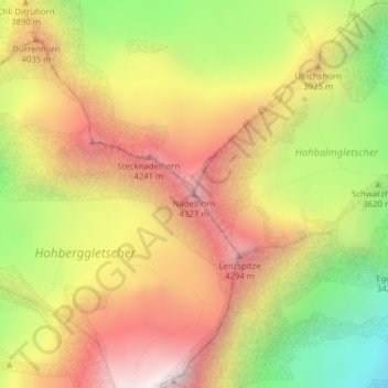
Carte topographique Nadelhorn, altitude, relief
À propos de cette carte
Nom : Carte topographique Nadelhorn, altitude, relief.
Lieu : Nadelhorn, Randa, Visp, Wallis, 3928, Schweiz (46.10883 7.86401 46.10893 7.86411)
Altitude moyenne : 3.765 m
Altitude minimum : 2.967 m
Altitude maximum : 4.456 m
Autres cartes topographiques
Cliquez sur une carte pour visualiser sa topographie, son altitude et son relief.