
Carte topographique Leek Wootton
Carte interactive
Cliquez sur la carte pour afficher l’altitude.
À propos de cette carte
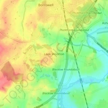
Nom : Carte topographique Leek Wootton, altitude, relief.
Altitude moyenne : 76 m
Altitude minimum : 47 m
Altitude maximum : 108 m
Autres cartes topographiques
Cliquez sur une carte pour visualiser sa topographie, son altitude et son relief.
Warwick Castle
United Kingdom > England > Warwickshire > Warwick
Warwick Castle, Northern Tower, Cliff Hill, Warwick, Warwickshire, England, CV34 4QX, United Kingdom
Altitude moyenne : 56 m
Sherbourne
United Kingdom > England > Warwickshire > Warwick
Sherbourne, Warwick, Warwickshire, England, United Kingdom
Altitude moyenne : 56 m
Warwick
United Kingdom > England > Warwickshire > Warwick
Warwick, Warwickshire, West Midlands, England, United Kingdom
Altitude moyenne : 87 m