
Carte topographique Valley End
Cliquez sur la carte pour afficher l’altitude.
À propos de cette carte
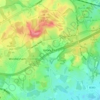
Nom : Carte topographique Valley End, altitude, relief.
Altitude moyenne : 56 m
Altitude minimum : 28 m
Altitude maximum : 99 m
Autres cartes topographiques
Cliquez sur une carte pour visualiser sa topographie, son altitude et son relief.
Chobham
United Kingdom > England > Surrey > Surrey Heath
The rolling basin below reaches lowest elevations of between 30 metres (98 ft) in the centre of the west and 20 metres (66 ft) where the rivers join in the centre of the east. The rivers at the western point are less than 100 metres (330 ft) apart; to the east end of the parish where the parish adjoins the…
Altitude moyenne : 43 m
Bagshot Park Mansion
United Kingdom > England > Surrey > Surrey Heath > Bagshot
Altitude moyenne : 76 m
Chobham Common
United Kingdom > England > Surrey > Surrey Heath > Chobham > Brick Hill
Altitude moyenne : 49 m
Frimley Lodge Park
United Kingdom > England > Surrey > Surrey Heath > Frimley Green
Altitude moyenne : 80 m
Chobham
United Kingdom > England > Surrey > Surrey Heath
The rolling basin below reaches lowest elevations of between 30 metres (98 ft) in the centre of the west and 20 metres (66 ft) where the rivers join in the centre of the east. The rivers at the western point are less than 100 metres (330 ft) apart; to the east end of the parish where the parish adjoins the…
Altitude moyenne : 43 m