
Carte topographique Iriga
Cliquez sur la carte pour afficher l’altitude.
À propos de cette carte
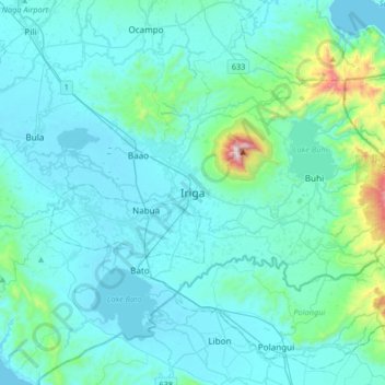
Nom : Carte topographique Iriga, altitude, relief.
Lieu : Iriga, Bicol Region, 4431, Philippines (13.26226 123.25294 13.58226 123.57294)
Altitude moyenne : 115 m
Altitude minimum : 0 m
Altitude maximum : 1.132 m
Autres cartes topographiques
Cliquez sur une carte pour visualiser sa topographie, son altitude et son relief.
Metro Manila
The Coastal Margin or Lowland is a flat and low plain that faces Manila Bay. Located here is Manila, Navotas, parts of Malabon, and the western part and reclaimed areas of Pasay and Parañaque, where the ground elevation ranges from zero meters on Manila Bay to five meters at the west side of the cities of…
Altitude moyenne : 43 m
Batangas
Batangas is a combination of plains and mountains, including one of the world's smallest volcanoes, Mt. Taal, with an elevation of 600 metres (2,000 ft), located in the middle of the Taal Lake. Other important peaks are Mount Macolod with an elevation of 830 metres (2,720 ft), Mt. Banoy with 960 metres (3,150…
Altitude moyenne : 126 m
Quezon City
In order to make Quezon's dream a reality and to mobilize funds for the land purchase, the People's Homesite Corporation (PHC) was created on October 14, 1938, as a subsidiary of NDC, with an initial capital of ₱2 million. Roces was the chairman of the Board of PHC, and they immediately acquired the vast…
Altitude moyenne : 39 m
Quezon
Rugged terrains characterize the province's topography with few plains, valleys, and swamps. The Sierra Madre Mountain Range runs along the entire length of the area, with Mount Banahaw (an active volcano) rising at 2,169 meters above sea level. Only narrow strips of land along the coast and river valleys are…
Altitude moyenne : 84 m
Laguna
Laguna is home to 24 mountains, most of which are inactive volcanoes. The highest peak in Laguna is Mt. Banahaw, with an elevation of 2,170 m (7,120 ft). Banahaw, unlike most other volcanoes in Laguna, is an active complex stratovolcano, which last erupted in 1843. Banahaw is located in the boundary of Laguna…
Altitude moyenne : 183 m
Isabela
The province is divided into three physiographic areas. The eastern area, straddled by the Sierra Madre mountain range, is rugged and thickly forested. A substantial portion is uncharted. These unexplored hinterlands are home to a rich variety of flora and fauna, and some are under government reservations. It…
Altitude moyenne : 227 m
Cagayan de Oro
Cagayan de Oro, located along the north-central coast of Mindanao, Philippines, encompasses a diverse topography that significantly influences its terrain. The city spans approximately 488.86 square kilometers (188.75 square miles), featuring a 25-kilometer (16 miles) coastline along Macajalar Bay. The…
Altitude moyenne : 224 m
Catanduanes
The topography of Catanduanes Island is rugged and mountainous, becoming more pronounced towards the central portion of the island. Less than 10 percent of the land area has a slope gradient under 8 percent, mostly fractured and narrow strips of plains located along the coastal areas where most of the…
Altitude moyenne : 35 m
Cavite
Another theory proposes that the name is a Hispanicized form of kabit, Tagalog for "joined", "connected", or "attached", referring to the peninsula's topographical relation to the mainland. Edmund Roberts, in his 1821 memoir, stated that the "natives" called it Caveit due to the "crooked point of land…
Altitude moyenne : 88 m
Lipa
At the celebration of the elevation of Lipa to a city in January 1888, José Rizal was invited by Dr. Jose Lozada, Catalino Dimayuga and the brothers Celestino and Simeon Luz but Rizal responded only with his Hymno Al Trabajo which he dedicated to the zeal and industry of the Lipeños.
Altitude moyenne : 208 m
Kibawe
Kibawe is a rich land at the center of Mindanao, located in southern Bukidnon. It is bounded in the north by the municipality of Dangcagan, on the south by the municipality of Damulog, on the east by the municipality of Magpet, North Cotabato, and on the west by the municipality of Kadingilan with Muleta River…
Altitude moyenne : 267 m
Kidapawan
Located in Kidapawan is the Paniki Falls Eco-River Park located at Umpan Village, Barangay Balabag. Kidapawan is also one of the most well-known starting points for trekking on Mount Apo via the city's Lake Agco in Barangay Ilomavis, Kidapawan-Santa Cruz, and Kidapawan-Magpet trails which towers at 10,311 feet…
Altitude moyenne : 495 m
Angeles
Sapangbato is the largest barangay in Angeles in terms of territory, with a total land area of 104,694 sq. meters and a population of 11,262. Located northwest of Angeles near Clark Freeport Zone, it is identified as the barangay in Angeles with the highest elevation of 750 feet above sea level. It is home to…
Altitude moyenne : 98 m
Basilan
Basilan National Park is at the eastern portion of the remaining public forest between the city of Isabela and the municipalities of Lamitan, Tipo-Tipo and Sumisip. The park has an elevation of 971 metres (3,186 ft) above sea level, and the tallest peak, Puno Mahaji or Basilan Peak, dominates the park's…
Altitude moyenne : 32 m
San Jose del Monte
The elevation of the city ranges from approximately 40 to 900 meters (130 to 2,950 ft) above sea level; the relief transitions from warm lowland to cool upland as one goes eastward. This is because the city is part of the Sierra Madre mountain range. Plains and river valley flats characterize the western and…
Altitude moyenne : 73 m
Muntinlupa
There are three plausible origins of the name of the city: First, is its association with the thin topsoil in the area; second, residents, purportedly replying to a question by Spaniards in the 16th century what the name of their place was, said “Monte sa Lupa”—apparently mistaking the question for what…
Altitude moyenne : 21 m
Iloilo
The province is divided into two distinct geographic regions; the highlands of the Central Panay Mountain Range on the western border and the lowland plains which account for a larger portion of the province. Small islands east of its northernmost tip also dot the Visayan Sea - of these, Pan de Azucar and…
Altitude moyenne : 129 m
Masbate
The general surface configuration of the province ranges from slightly undulating to rolling and from hilly to mountainous. In each island, the rugged topography is concentrated in the northeastern portion and gradually recedes to blunt hills and rolling areas in the south, southeast, and southwest.
Altitude moyenne : 28 m
Cebu
Coal was first discovered in Cebu about 1837. There were 15 localities over the whole island, on both coasts; some desultory mining had been carried out Naga near Mount Uling, but most serious operations were at Licos and Camansi west of Compostela and Danao. Active work ceased about 1895 with insurrections,…
Altitude moyenne : 91 m
Canduman
It is one of the two (the other one being the municipality of Consolacion) local government units located within the mainland Metro Cebu where the elevation of land is less than 100 m (330 ft).
Altitude moyenne : 29 m
Pangil
The municipality is strategically situated at the southern tip of Sierra Madre mountain range (six barangays) and along the eastern margin of Jalajala Peninsula and just west of the northwestern shore of the easternmost major embayment of Laguna de Bay (two barangays). Its narrow strip of territory traverses…
Altitude moyenne : 165 m
Bukidnon
Situated within Bukidnon is Mount Dulang-dulang, the 2nd highest mountain in the country, with an elevation of 2,938 metres (9,639 ft) located in the Kitanglad Mountain Range. Mount Kitanglad (2,899 m), Mount Kalatungan (2,860 m), Mount Maagnaw (2,742 m), Mount Lumuluyaw (2,612 m), and Mount Tuminungan (2,400…
Altitude moyenne : 686 m
Tarlac
Like the rest of Central Luzon, the province has three distinct seasons: summer from March to June, monsoon rain from July to early October, and monsoon winter from late October to February. Summer months, especially during May bring frequent, sometimes severe, thunderstorms with high winds, thunder, and hail.…
Altitude moyenne : 217 m
Dinagat Islands
Dinagat Islands is a young island-province at the northern tip of Mindanao. Many describe Dinagat Islands as a hidden gem of the Caraga Region XIII. The Islands are enriched with great bio-diversity, abundant natural wonders and rich resources. Dinagat Islands has a multitude of fascinating white sandy beaches…
Altitude moyenne : 24 m
Sumilao
Generally, Sumilao's physical configuration is characterized by extreme features. From the south to the central portion moving towards the north and north-western areas are mountain ranges, canyons, and high relief topography, including part of Mt. Kitanglad, the second highest mountain peak in the…
Altitude moyenne : 1.001 m
Tagum
One of the significant accomplishments of the officialdom of Tagum during the 1990s was its elevation from a second to the first-class municipality. This opened a gateway to increase its financial resources through the Internal Revenue Allocation (IRA) from the national government and local revenues. This was…
Altitude moyenne : 95 m
Bacolod
Bacólod (English: Bacolod), is derived from bakólod (Old Spelling: bacólod), the Old Hiligaynon (Old Ilonggo) (Old Spelling: Ylongo and Ilongo) word for a "hill, turtle, mound, rise, hillock, down, any small eminence or elevation", since the resettlement was founded on a stony, hilly area, now the barangay…
Altitude moyenne : 54 m
Zamboanga City
The overall topography of the city could be described as rolling to very steep. There are some flat lands, mostly narrow strips along the east coast. The urban center is mostly flat with a gentle slope to the interior, ranging from 0% to 3%. A portion, about 38,000 hectares, has slopes ranging from 18% to 30%.…
Altitude moyenne : 78 m
Tagaytay
It is one of the country's most popular destinations for domestic tourism because of its scenery and cooler climate provided by its altitude. Tagaytay overlooks Taal Lake in Batangas and provides views of Taal Volcano Island in the middle of the lake through various vantage points situated in the city.
Altitude moyenne : 348 m
Aurora
The province covers a portion of the Sierra Madre mountain range. As such, the elevation is generally steep to very steep and only about 14% of the province's total area is flat.
Altitude moyenne : 255 m
Kalinga
Large swaths of the province's lowlands are open grassland suitable for pasture, while the highlands have extensive areas of tropical rainforest. In higher elevations to the west, particularly in the mountains of Balbalan, lie some of the most intact pine forests of Luzon island. Rizal and Tabuk with their…
Altitude moyenne : 667 m
Ilocos Sur
Ilocos Sur occupies the central section of the Ilocos Region in northern Luzon. It is bordered by Ilocos Norte to the north, Abra to the northeast, Mountain Province to the east, Benguet to the southeast, La Union to the south, and the South China Sea to the west. Its area of 2,596.00 square kilometres…
Altitude moyenne : 468 m