

Cartes topographiques Blythe
Cliquez sur une carte pour visualiser sa topographie, son altitude et son relief.
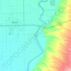
Colorado River
United States > California > Riverside County > Blythe
The entire eastern boundary of the Colorado River Basin runs along the North American Continental Divide and is defined largely by the Rocky Mountains and the Rio Grande Basin. The Wind River Range in Wyoming marks the northern extent of the basin, and is separated from the Colorado Rockies by the endorheic…
Altitude moyenne : 102 m