Cartes topographiques Warsaw
Cliquez sur une carte pour visualiser sa topographie, son altitude et son relief.
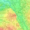
Warsaw
Poland > Masovian Voivodeship > Warsaw
Warsaw lies in east-central Poland about 300 kilometres (190 mi) from the Carpathian Mountains and about 260 kilometres (160 mi) from the Baltic Sea, 523 kilometres (325 mi) east of Berlin, Germany. The city straddles the Vistula River. It is located in the heartland of the Masovian Plain, and its average…
Altitude moyenne : 95 m