
Carte topographique Warwick
Cliquez sur la carte pour afficher l’altitude.
Warwick
Warwick has a humid subtropical climate (Köppen Cfa) with hot summers and cool to cold winters. It is slightly cooler and less humid than the proximate southeast Queensland coast due to its inland, elevation location. Frost is present in winter. The climate bears similarities with Richmond, an inland suburb of Sydney, in central New South Wales.
À propos de cette carte
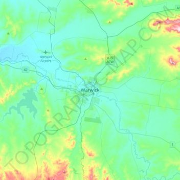
Nom : Carte topographique Warwick, altitude, relief.
Altitude moyenne : 517 m
Altitude minimum : 430 m
Altitude maximum : 903 m
Autres cartes topographiques
Cliquez sur une carte pour visualiser sa topographie, son altitude et son relief.