
Carte topographique Howard County
Carte interactive
Cliquez sur la carte pour afficher l’altitude.
À propos de cette carte
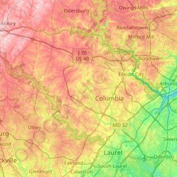
Nom : Carte topographique Howard County, altitude, relief.
Lieu : Howard County, Maryland, USA (39.10306 -77.18698 39.36954 -76.69636)
Altitude moyenne : 128 m
Altitude minimum : 2 m
Altitude maximum : 266 m
Autres cartes topographiques
Cliquez sur une carte pour visualiser sa topographie, son altitude et son relief.
Cockeysville
USA > Maryland > Cockeysville
Cockeysville, Baltimore County, Maryland, 21031, USA
Altitude moyenne : 131 m
Grahams Green Acres
USA > Maryland > Grahams Green Acres
Grahams Green Acres, Carroll County, Maryland, 21776, USA
Altitude moyenne : 223 m
College Park
USA > Maryland > College Park
College Park, Prince George's County, Maryland, USA
Altitude moyenne : 38 m