
Faire un don
Équipez-vous pour votre prochaine aventure :
En tant que Partenaire Amazon, ce site perçoit une commission sur les achats éligibles sans surcoût pour vous.
Carte topographique Snake River
Cliquez sur la carte pour afficher l’altitude.
Faire un don
Équipez-vous pour votre prochaine aventure :
En tant que Partenaire Amazon, ce site perçoit une commission sur les achats éligibles sans surcoût pour vous.
Snake River
Due to the rain shadow effect of the Cascades, precipitation as a whole is scant, averaging 14 inches (360 mm) across the entire watershed. Most precipitation falls at higher elevations as snow, thus, most runoff in the Snake River watershed derives from snowmelt. Jackson Hole, Wyoming experiences an alpine climate with an average of 30 in (760 mm) of rain and 252 in (6,400 mm) of snow. The coldest month is January, with a mean temperature of 13 °F (−11 °C), and the hottest is July at 57.7 °F (14.3 °C). Twin Falls experiences a semi-arid climate, with about 9 in (230 mm) of rain and 13 in (330 mm) of snow. Monthly mean temperatures range from 29.4 °F (−1.4 °C) in January to 73.1 °F (22.8 °C) in July. The Columbia Basin around the river's mouth also has a semi-arid climate, with about 10 in (250 mm) of rain and 5 in (130 mm) of snow as measured at Ice Harbor Dam. January is the coldest month with a mean temperature of 34.3 °F (1.3 °C), and July is the hottest month at 74.6 °F (23.7 °C).
Faire un don
Équipez-vous pour votre prochaine aventure :
En tant que Partenaire Amazon, ce site perçoit une commission sur les achats éligibles sans surcoût pour vous.
À propos de cette carte
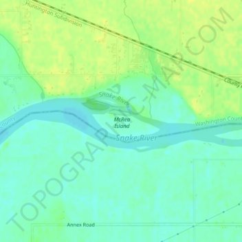
Nom : Carte topographique Snake River, altitude, relief.
Lieu : Snake River, Washington County, Idaho, United States (44.24618 -117.02654 44.24923 -117.00892)
Altitude moyenne : 644 m
Altitude minimum : 635 m
Altitude maximum : 653 m
Faire un don
Équipez-vous pour votre prochaine aventure :
En tant que Partenaire Amazon, ce site perçoit une commission sur les achats éligibles sans surcoût pour vous.
Autres cartes topographiques
Cliquez sur une carte pour visualiser sa topographie, son altitude et son relief.
Weiser
United States > Idaho > Washington County
Weiser is located at 44°14′59″N 116°58′4″W / 44.24972°N 116.96778°W / 44.24972; -116.96778 (44.249712, -116.967799), at an elevation of 2,129 feet (649 m) above sea level.
Altitude moyenne : 673 m