
Carte topographique Stockton-on-the-Forest
Carte interactive
Cliquez sur la carte pour afficher l’altitude.
À propos de cette carte
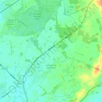
Nom : Carte topographique Stockton-on-the-Forest, altitude, relief.
Lieu : Stockton-on-the-Forest, York, England, United Kingdom (53.97843 -1.02867 54.03956 -0.96684)
Altitude moyenne : 22 m
Altitude minimum : 11 m
Altitude maximum : 47 m
Autres cartes topographiques
Cliquez sur une carte pour visualiser sa topographie, son altitude et son relief.
Osbaldwick
United Kingdom > England > York
Osbaldwick, York, England, United Kingdom
Altitude moyenne : 16 m
Dunnington
United Kingdom > England > York > Dunnington
Dunnington, York, Yorkshire and the Humber, England, United Kingdom
Altitude moyenne : 15 m