
Carte topographique Indang
Cliquez sur la carte pour afficher l’altitude.
Indang
The topography of Indang is characterised by gently sloping or rolling terrain. Almost 40.36% of its total land area is within the slope grade of 3-8%, while 2,135 hectares is within the slope range of 8-15% which is characterised by undulating or sloping terrain.
À propos de cette carte
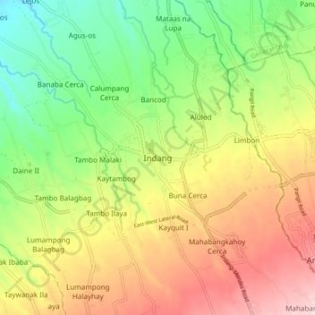
Nom : Carte topographique Indang, altitude, relief.
Lieu : Indang, Cavite, Calabarzon, 4122, Philippines (14.15584 120.83838 14.23584 120.91838)
Altitude moyenne : 298 m
Altitude minimum : 150 m
Altitude maximum : 477 m
Autres cartes topographiques
Cliquez sur une carte pour visualiser sa topographie, son altitude et son relief.