
Carte topographique Gatesgarth
Cliquez sur la carte pour afficher l’altitude.
À propos de cette carte
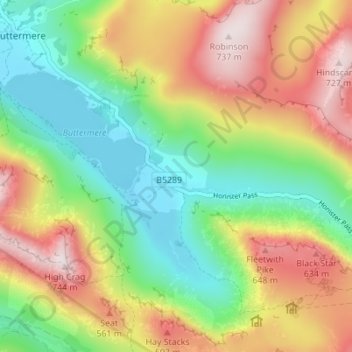
Nom : Carte topographique Gatesgarth, altitude, relief.
Lieu : Gatesgarth, Buttermere, Cumberland, England, United Kingdom (54.50489 -3.26554 54.54489 -3.22554)
Altitude moyenne : 369 m
Altitude minimum : 99 m
Altitude maximum : 736 m