
Carte topographique Vallegrande
Carte interactive
Cliquez sur la carte pour afficher l’altitude.
Vallegrande
The town lies in a big valley (hence the name) at an altitude of 2,030 m (6,660 ft) and has approximately 6,000 inhabitants. It has a mild temperate climate due mainly to its valley location, altitude, and the cold winter fronts the sweep the plains of Santa Cruz known as "Surazo".
À propos de cette carte
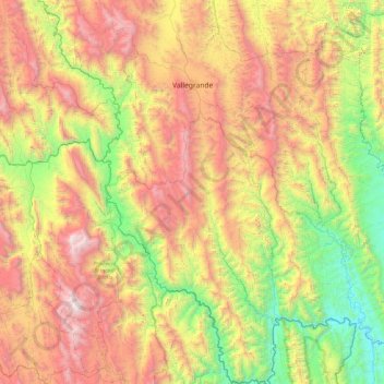
Nom : Carte topographique Vallegrande, altitude, relief.
Lieu : Vallegrande, Santa Cruz, Bolivia (-19.18451 -64.30318 -18.29254 -63.53131)
Altitude moyenne : 1.694 m
Altitude minimum : 505 m
Altitude maximum : 3.430 m