
Carte topographique Loch Raven Reservoir
Carte interactive
Cliquez sur la carte pour afficher l’altitude.
À propos de cette carte
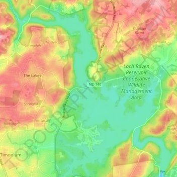
Nom : Carte topographique Loch Raven Reservoir, altitude, relief.
Altitude moyenne : 113 m
Altitude minimum : 53 m
Altitude maximum : 181 m
Autres cartes topographiques
Cliquez sur une carte pour visualiser sa topographie, son altitude et son relief.
Mingo Branch
United States > Maryland > Towson
Mingo Branch, Baltimore County, Maryland, 21120, United States
Altitude moyenne : 173 m
Hart-Miller Island
Hart-Miller Island, Towson, Baltimore County, Maryland, USA
Altitude moyenne : 2 m
The Bunker
The Bunker, Towson, Baltimore County, Maryland, USA
Altitude moyenne : 152 m
Cromwell Valley Park
Cromwell Valley Park, Satyr Hill Estates, Towson, Baltimore County, Maryland, USA
Altitude moyenne : 106 m