
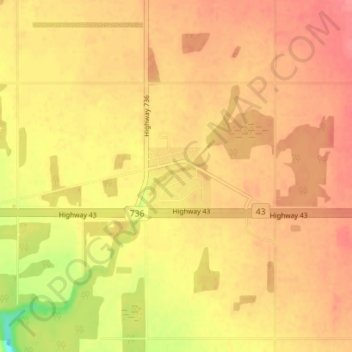
Carte topographique DeBolt
Carte interactive
Cliquez sur la carte pour afficher l’altitude.
À propos de cette carte
Nom : Carte topographique DeBolt, altitude, relief.
Altitude moyenne : 644 m
Altitude minimum : 599 m
Altitude maximum : 664 m
DeBolt is located in Peace Country, 58 km (36 mi) east from Grande Prairie and 54 km (34 mi) west of Valleyview along Highway 43. It lies in the Smoky River valley, at an elevation of 640 m (2,100 ft).
Autres cartes topographiques
Cliquez sur une carte pour visualiser sa topographie, son altitude et son relief.
Musreau Lake
Canada > Alberta > Municipal District of Greenview
Musreau Lake, Municipal District of Greenview, Alberta, Canada
Altitude moyenne : 889 m
Kakwa Mountain
Canada > Alberta > Municipal District of Greenview
Kakwa Mountain, Municipal District of Greenview, Alberta, Canada
Altitude moyenne : 1.787 m
Little Smoky
Canada > Alberta > Municipal District of Greenview > Little Smoky
Little Smoky, Municipal District of Greenview, Alberta, Canada
Altitude moyenne : 682 m