
Carte topographique Six Fields Nature Reserve
Carte interactive
Cliquez sur la carte pour afficher l’altitude.
À propos de cette carte
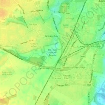
Nom : Carte topographique Six Fields Nature Reserve, altitude, relief.
Altitude moyenne : 18 m
Altitude minimum : 1 m
Altitude maximum : 30 m
Autres cartes topographiques
Cliquez sur une carte pour visualiser sa topographie, son altitude et son relief.
Stockton-on-Tees
United Kingdom > England > Stockton-on-Tees > Stockton-on-Tees
Stockton-on-Tees, North East England, England, United Kingdom
Altitude moyenne : 17 m
Stockton-on-Tees
United Kingdom > England > Stockton-on-Tees > Stockton-on-Tees
Stockton-on-Tees, North East England, England, TS18 1A, United Kingdom
Altitude moyenne : 20 m