
Carte topographique Randogne
Carte interactive
Cliquez sur la carte pour afficher l’altitude.
À propos de cette carte
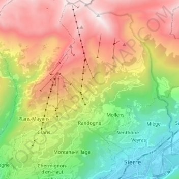
Nom : Carte topographique Randogne, altitude, relief.
Lieu : Randogne, Crans-Montana, Sierre, Wallis, 3960, Switzerland (46.28388 7.47796 46.37191 7.51993)
Altitude moyenne : 1.614 m
Altitude minimum : 521 m
Altitude maximum : 2.977 m
The former municipality is located in the Sierre district, on the northern slope of the Rhone valley. The municipality goes from the Rhone valley at an elevation of 540 m (1,770 ft) to Mont Bonvin at 2,995 m (9,826 ft). It consists of the village of Randogne (which was rebuilt in stone after the destructive fire of 1898), the village of Loc, portions of the village of Darnona and Bluche, as well as the majority of the resort of Montana-Vermala and Montana-Station.