
Carte topographique Oberes Sudelfeld
Carte interactive
Cliquez sur la carte pour afficher l’altitude.
À propos de cette carte
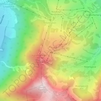
Nom : Carte topographique Oberes Sudelfeld, altitude, relief.
Altitude moyenne : 1.216 m
Altitude minimum : 795 m
Altitude maximum : 1.702 m
Autres cartes topographiques
Cliquez sur une carte pour visualiser sa topographie, son altitude et son relief.
Geitau
Deutschland > Bayern > Landkreis Miesbach > Bayrischzell
Geitau, Bayrischzell, Landkreis Miesbach, Bayern, 83735, Deutschland
Altitude moyenne : 924 m