
Carte topographique Holtham
Carte interactive
Cliquez sur la carte pour afficher l’altitude.
À propos de cette carte
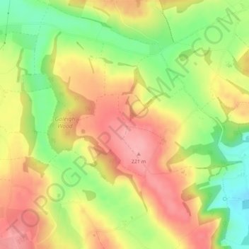
Nom : Carte topographique Holtham, altitude, relief.
Altitude moyenne : 170 m
Altitude minimum : 108 m
Altitude maximum : 221 m
Autres cartes topographiques
Cliquez sur une carte pour visualiser sa topographie, son altitude et son relief.
Steep
United Kingdom > England > Hampshire > East Hampshire > Steep
Steep, East Hampshire, Hampshire, England, United Kingdom
Altitude moyenne : 115 m