
Carte topographique Bull Hill
Carte interactive
Cliquez sur la carte pour afficher l’altitude.
À propos de cette carte
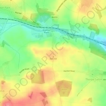
Nom : Carte topographique Bull Hill, altitude, relief.
Altitude moyenne : 111 m
Altitude minimum : 75 m
Altitude maximum : 145 m
Autres cartes topographiques
Cliquez sur une carte pour visualiser sa topographie, son altitude et son relief.
Thrybergh
United Kingdom > England > Rotherham
Thrybergh, Rotherham, South Yorkshire, England, United Kingdom
Altitude moyenne : 48 m