
Carte topographique Burum
Carte interactive
Cliquez sur la carte pour afficher l’altitude.
À propos de cette carte
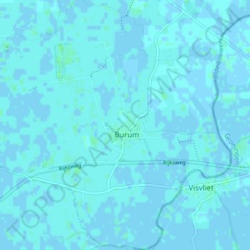
Nom : Carte topographique Burum, altitude, relief.
Lieu : Burum, Noardeast-Fryslân, Friesland, Nederland (53.25663 6.20311 53.29338 6.25581)
Altitude moyenne : 1 m
Altitude minimum : -2 m
Altitude maximum : 4 m
Het dorp heeft een eigen basisschool, de christelijke basisschool Op de Hoogte.
Autres cartes topographiques
Cliquez sur une carte pour visualiser sa topographie, son altitude et son relief.
Oudemirdum
Oudemirdum, De Fryske Marren, Friesland, Nederland
Altitude moyenne : 0 m
Nederlandse Waddeneilanden
Nederlandse Waddeneilanden, Friesland, Nederland
Altitude moyenne : 1 m
Noordwolde
Nederland > Friesland > Weststellingwerf > Noordwolde
Noordwolde, Weststellingwerf, Friesland, Nederland
Altitude moyenne : 4 m
West-Terschelling
Nederland > Friesland > Terschelling
West-Terschelling, Terschelling, Friesland, Nederland
Altitude moyenne : 0 m
Terherne
Nederland > Friesland > De Fryske Marren
Terherne, De Fryske Marren, Friesland, Nederland, 8493RC, Nederland
Altitude moyenne : -1 m
De Westereen
Nederland > Friesland > Dantumadiel
De Westereen, Dantumadiel, Friesland, Nederland
Altitude moyenne : 1 m
Damwâld
Nederland > Friesland > Dantumadiel > Damwâld
Damwâld, Dantumadiel, Friesland, Nederland, 9104, Nederland
Altitude moyenne : 1 m
Lombok
Nederland > Friesland > Noordwolde-Zuid
Lombok, Noordwolde-Zuid, Noordwolde, Weststellingwerf, Friesland, Nederland, 8391 KH, Nederland
Altitude moyenne : 4 m
Boornbergum
Nederland > Friesland > Smallingerland
Boornbergum, Smallingerland, Friesland, Nederland
Altitude moyenne : 0 m
Annebuorren
Nederland > Friesland > Oudeschoot
Annebuorren, Oudeschoot, Heerenveen, Friesland, Nederland, 8451 KC, Nederland
Altitude moyenne : 2 m
Canadameer (Aekingermeer)
Nederland > Friesland > Elsloo
Canadameer (Aekingermeer), Elsloo, Ooststellingwerf, Friesland, Nederland
Altitude moyenne : 9 m
Kootstertille
Nederland > Friesland > Achtkarspelen
Kootstertille, Achtkarspelen, Friesland, Nederland, 9288AW, Nederland
Altitude moyenne : 2 m
Lippenhuizen
Nederland > Friesland > Opsterland
Lippenhuizen, Opsterland, Friesland, Nederland
Altitude moyenne : 2 m
Rottevalle
Nederland > Friesland > Smallingerland
Rottevalle, Smallingerland, Friesland, Nederland
Altitude moyenne : 2 m
Sint Nicolaasga
Sint Nicolaasga, De Fryske Marren, Friesland, Nederland
Altitude moyenne : 1 m
Drachtstercompagnie
Nederland > Friesland > Drachtstercompagnie
Drachtstercompagnie, Smallingerland, Friesland, Nederland
Altitude moyenne : 3 m
Trijehuzen
Nederland > Friesland > Hidaard
Trijehuzen, Hidaard, Súdwest-Fryslân, Friesland, Nederland, 8737 JL, Nederland
Altitude moyenne : -1 m
Voorwerk
Nederland > Friesland > Siegerswoude
Voorwerk, Siegerswoude, Opsterland, Friesland, Nederland, 9248 SL, Nederland
Altitude moyenne : 5 m
Surhuizumer Mieden
Nederland > Friesland > Surhuizum
Surhuizumer Mieden, Surhuizum, Achtkarspelen, Friesland, Nederland, 9283 XX, Nederland
Altitude moyenne : 0 m
Leeuwarden
Nederland > Friesland > Leeuwarden
Leeuwarden, Friesland, Nederland, 8911BR, Nederland
Altitude moyenne : 0 m
Tijnje
Nederland > Friesland > Leeuwarden
Tijnje, Leeuwarden, Friesland, Nederland, 8924BC, Nederland
Altitude moyenne : 2 m
Echtenerbrug
Echtenerbrug, De Fryske Marren, Friesland, Nederland
Altitude moyenne : -1 m