Géolocaliser
👉 Easily get elevation data in JSON, GeoTIFF and KML formats using Elevation API
Merci de soutenir ce site ❤️
Faire un don

Carte topographique Mount Sungay

Cliquez sur la carte pour afficher l’altitude.

👉 Easily get elevation data in JSON, GeoTIFF and KML formats using Elevation API
Merci de soutenir ce site ❤️
Faire un don

Mount Sungay

The mountain peak was previously much higher with an elevation of 752 meters (2,467 ft), Its former profile, "a sharp peak at the eastern end of a table of land (Tagaytay Ridge)", was one of the visible landmarks used by early navigators when sailing to and around Manila Bay. It was conical in shape with steep sides deemed "inaccessible", topped by distinct rock formations that resembled horns, (Tagalog: sungay), hence the name.

Wikipedia (CC-BY-SA 3.0)

À propos de cette carte

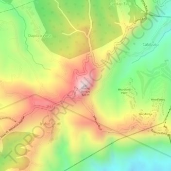
Nom : Carte topographique Mount Sungay, altitude, relief.

Lieu : Mount Sungay, Tagaytay, Cavite, Calabarzon, 4120, Philippines (14.14187 121.02197 14.14197 121.02207)

Altitude moyenne : 501 m

Altitude minimum : 264 m

Altitude maximum : 728 m

Autres cartes topographiques

Cliquez sur une carte pour visualiser sa topographie, son altitude et son relief.

Patutong Malaki North

Philippines > Cavite > Tagaytay

Altitude moyenne : 568 m

Silang Crossing East

Philippines > Cavite > Tagaytay

Altitude moyenne : 469 m

Neogan

Philippines > Cavite > Tagaytay

Altitude moyenne : 576 m

Picnic Grove

Philippines > Cavite > Tagaytay > Iruhin South

Altitude moyenne : 474 m

Guinhawa North

Philippines > Cavite > Tagaytay

Altitude moyenne : 563 m

Kaybagal South

Philippines > Cavite > Tagaytay

Altitude moyenne : 488 m

Bagong Tubig

Philippines > Cavite > Tagaytay

Altitude moyenne : 432 m

Maitim II Central

Philippines > Cavite > Tagaytay

Altitude moyenne : 581 m

Mendez Crossing East

Philippines > Cavite > Tagaytay

Altitude moyenne : 560 m

Zambal

Philippines > Cavite > Tagaytay

Altitude moyenne : 574 m

Sambong

Philippines > Cavite > Tagaytay

Altitude moyenne : 371 m

Kaybagal South

Philippines > Cavite > Tagaytay

Altitude moyenne : 488 m

Maitim II Central

Philippines > Cavite > Tagaytay

Altitude moyenne : 581 m

Sambong

Philippines > Cavite > Tagaytay

Altitude moyenne : 371 m

Maharlika West

Philippines > Cavite > Tagaytay

Altitude moyenne : 497 m

Bagong Tubig

Philippines > Cavite > Tagaytay

Altitude moyenne : 432 m

Maitim II West

Philippines > Cavite > Tagaytay

Altitude moyenne : 585 m

Kaybagal South

Philippines > Cavite > Tagaytay

Altitude moyenne : 488 m

Équipez-vous pour votre prochaine aventure :

📏Télémètres laser - Mesure de distance en extérieur
🗺️Cartes du monde murales - Décoration et géographie
🥪Lunch Boxes Robustes - Transportez vos repas sans risque de fuite dans le sac
🎒Housses de Sac à Dos - Gardez vos affaires sèches en toute circonstance
🚶Guêtres de Protection - Évitez la boue et l'eau dans vos chaussures

En tant que Partenaire Amazon, ce site perçoit une commission sur les achats éligibles sans surcoût pour vous.