
Carte topographique Galdhøpiggen
Carte interactive
Cliquez sur la carte pour afficher l’altitude.
À propos de cette carte
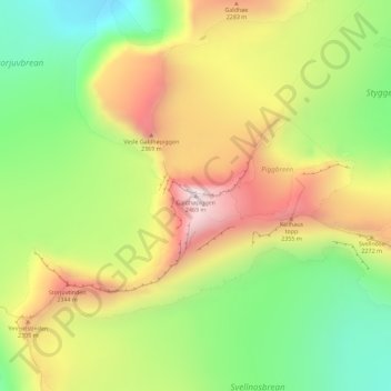
Nom : Carte topographique Galdhøpiggen, altitude, relief.
Lieu : Galdhøpiggen, Lom, Innlandet, Norway (61.63642 8.31239 61.63652 8.31249)
Altitude moyenne : 2.105 m
Altitude minimum : 1.791 m
Altitude maximum : 2.467 m
At Juvasshytta there is an alpine ski resort with lift on a glacier, reaching an elevation of 2,200 metres (7,200 ft) above sea level, the highest in Scandinavia. It is called Galdhøpiggen Summer Ski Centre and is open from June and all the summer when the road is open.
Autres cartes topographiques
Cliquez sur une carte pour visualiser sa topographie, son altitude et son relief.