
Carte topographique Albulapass
Carte interactive
Cliquez sur la carte pour afficher l’altitude.
À propos de cette carte
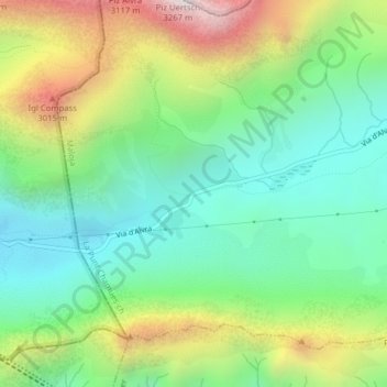
Nom : Carte topographique Albulapass, altitude, relief.
Altitude moyenne : 2.560 m
Altitude minimum : 2.202 m
Altitude maximum : 3.228 m
The Albula Pass is an important axis from central Graubünden to Engadin. It is traversed by a paved road from Thusis to La Punt, via Bergün. It is also traversed by the Albula Railway, although at a lower elevation through the Albula Tunnel (1,820 m), from Thusis to Bever, also via Bergün.