
Carte topographique Ingenbohl
Carte interactive
Cliquez sur la carte pour afficher l’altitude.
À propos de cette carte
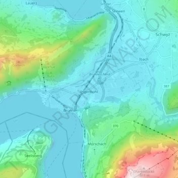
Nom : Carte topographique Ingenbohl, altitude, relief.
Lieu : Ingenbohl, Schwyz, 6440, Switzerland (46.98233 8.54903 47.02105 8.64196)
Altitude moyenne : 674 m
Altitude minimum : 414 m
Altitude maximum : 1.893 m
Autres cartes topographiques
Cliquez sur une carte pour visualiser sa topographie, son altitude et son relief.
Rigi
Switzerland > Schwyz > Schwyz > Arth
Rigi, Arth, Schwyz, 6356, Switzerland
Altitude moyenne : 1.265 m
Rickenbach
Switzerland > Schwyz > Schwyz > Schwyz
Rickenbach, Schwyz, 6432, Switzerland
Altitude moyenne : 751 m