
Faire un don
Équipez-vous pour votre prochaine aventure :
En tant que Partenaire Amazon, ce site perçoit une commission sur les achats éligibles sans surcoût pour vous.
Carte topographique Vellore Fort
Cliquez sur la carte pour afficher l’altitude.
Faire un don
Équipez-vous pour votre prochaine aventure :
En tant que Partenaire Amazon, ce site perçoit une commission sur les achats éligibles sans surcoût pour vous.
Vellore Fort
It is mentioned that "there is no such fort on the face of earth like the one in Vellore. It had a deep wet ditch (moat) where once 10,000 crocodiles swarmed, waiting to grab every intruder into this impregnable fort. It has huge double walls with bastions projecting irregularly, where two carts can be driven abreast". The fort was constructed in granite from the nearby quarries in Arcot and Chittoor districts. It spreads over an area of 133 acres (0.54 km2) and is located at an altitude of 220 m (720 ft) within a broken mountain range. The fort is surrounded by a moat which was once used as an additional line of defence in the case of an invasion. It was supposed to have included an escape tunnel leading to Virinjipuram about 12 km (7.5 mi) away, which could be used by the king and other royals in the event of an attack. This report was however later disputed by researchers of the ASI who found no evidence of the existence of such a passage. The fort is considered to be amongst the best examples of military architecture in Southern India and is known for its grand ramparts, wide moat and robust masonry.
Faire un don
Équipez-vous pour votre prochaine aventure :
En tant que Partenaire Amazon, ce site perçoit une commission sur les achats éligibles sans surcoût pour vous.
À propos de cette carte
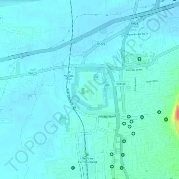
Nom : Carte topographique Vellore Fort, altitude, relief.
Altitude moyenne : 214 m
Altitude minimum : 205 m
Altitude maximum : 268 m
Faire un don
Équipez-vous pour votre prochaine aventure :
En tant que Partenaire Amazon, ce site perçoit une commission sur les achats éligibles sans surcoût pour vous.