
Carte topographique Ayr
Carte interactive
Cliquez sur la carte pour afficher l’altitude.
À propos de cette carte
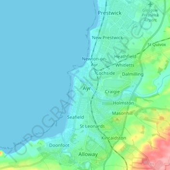
Nom : Carte topographique Ayr, altitude, relief.
Lieu : Ayr, South Ayrshire, Scotland, KA7 1NE, United Kingdom (55.42280 -4.67025 55.50280 -4.59025)
Altitude moyenne : 18 m
Altitude minimum : -1 m
Altitude maximum : 120 m
Autres cartes topographiques
Cliquez sur une carte pour visualiser sa topographie, son altitude et son relief.
Carnell (Carnhill)
United Kingdom > Scotland > South Ayrshire
Carnell (Carnhill), South Ayrshire, Scotland, KA1 5JS, United Kingdom
Altitude moyenne : 96 m
Ballantrae
United Kingdom > Scotland > South Ayrshire
Ballantrae, South Ayrshire, Scotland, KA26 0NB, United Kingdom
Altitude moyenne : 28 m