
Carte topographique Piz Vadret
Carte interactive
Cliquez sur la carte pour afficher l’altitude.
À propos de cette carte
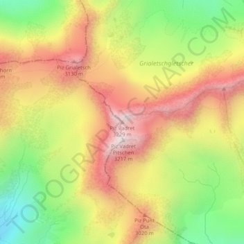
Nom : Carte topographique Piz Vadret, altitude, relief.
Altitude moyenne : 2.824 m
Altitude minimum : 2.426 m
Altitude maximum : 3.190 m
Piz Vadret is a mountain of the Albula Alps, in Graubünden. With an altitude of 3,229 metres above sea level, Piz Vadret is the highest mountain of the Albula Alps north of Piz Kesch. At the base of the north face lies a glacier named Vadret da Grialetsch. The closest locality is Brail, in the Engadin.