Géolocaliser

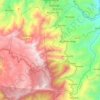
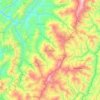
Carte topographique Kohīma

Cliquez sur la carte pour afficher l’altitude.

À propos de cette carte
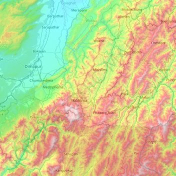
Nom : Carte topographique Kohīma, altitude, relief.

Lieu : Kohīma, Kohima, Nagaland, 797003, India (25.05000 93.46667 26.45000 94.86667)

Altitude moyenne : 1.001 m

Altitude minimum : 93 m

Altitude maximum : 2.997 m

Autres cartes topographiques

Cliquez sur une carte pour visualiser sa topographie, son altitude et son relief.
Chumukedima

India > Nagaland

Altitude moyenne : 221 m

Wokha

India > Nagaland

It covers an area of 1,628 sq. km. which equals around 9.82% of the total area of Nagaland. Of the total area, 35.74% comes under subtropical hill zone, 23.64% under subtropical plain zone and 40.59% in the mild tropical hill zone. The average altitude of the Wokha (Upper Range) is 1000-1500m above sea level;…

Altitude moyenne : 466 m
Tuensang

India > Nagaland

Altitude moyenne : 1.475 m

Jakhama

India > Nagaland

Altitude moyenne : 1.907 m

Ralan

India > Nagaland

Altitude moyenne : 383 m

Tobu

India > Nagaland > Mon

Altitude moyenne : 1.356 m

Phor

India > Nagaland

Altitude moyenne : 1.160 m

Pedi (Ngwalwa)

India > Nagaland

Altitude moyenne : 1.166 m

Doyang HEP Dam

India > Nagaland > Englan

Altitude moyenne : 365 m

Tseminyu

India > Nagaland

Altitude moyenne : 830 m

Doyang

India > Nagaland > Sanis > Sanis

Altitude moyenne : 552 m

Kiphire

India > Nagaland

Altitude moyenne : 1.502 m

Longleng

India > Nagaland

Altitude moyenne : 788 m

Noklak

India > Nagaland

Altitude moyenne : 1.694 m

Équipez-vous pour votre prochaine aventure :

🚶Guêtres de Protection - Évitez la boue et l'eau dans vos chaussures
🧴Baumes à Lèvres UV - Protection contre le vent et le soleil en altitude
🔋Adaptateurs de Prise - Pour les touristes explorant la Belgique
🚑Kits de Secours Voyage - Soignez les petits bobos en randonnée
🔥Réchauds de camping - Réchauds portables pour cuisine outdoor

En tant que Partenaire Amazon, ce site perçoit une commission sur les achats éligibles sans surcoût pour vous.