
Carte topographique Khuzdar
Carte interactive
Cliquez sur la carte pour afficher l’altitude.
À propos de cette carte
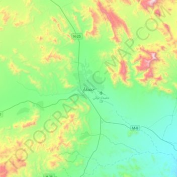
Nom : Carte topographique Khuzdar, altitude, relief.
Altitude moyenne : 1.417 m
Altitude minimum : 1.033 m
Altitude maximum : 2.438 m
Khuzdar is at the apex of a narrow valley at an elevation of 1,237 metres (4,058 ft). Despite this altitude, Khuzdar like most of Balochistan has an arid climate (Köppen BWh) with very low and erratic rainfall. Unlike most parts of the province, the heaviest average rainfall comes from the Asian monsoon in July and August, though this rainfall tends to be very erratic and in many summers there is no significant rain at all.
Autres cartes topographiques
Cliquez sur une carte pour visualiser sa topographie, son altitude et son relief.
Khuzdar Tehsil
Pakistan > Balochistan > Khuzdar District
Khuzdar Tehsil, Khuzdar District, Qalat Division, Balochistan, 89100, Pakistan
Altitude moyenne : 985 m