
Carte topographique Armstrong Creek
Carte interactive
Cliquez sur la carte pour afficher l’altitude.
À propos de cette carte
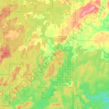
Nom : Carte topographique Armstrong Creek, altitude, relief.
Altitude moyenne : 447 m
Altitude minimum : 391 m
Altitude maximum : 511 m
Autres cartes topographiques
Cliquez sur une carte pour visualiser sa topographie, son altitude et son relief.
Franklin Lake
United States > Wisconsin > Forest County
Franklin Lake, Town of Hiles, Forest County, Wisconsin, United States
Altitude moyenne : 523 m
Argonne
United States > Wisconsin > Forest County
Argonne, Town of Argonne, Forest County, Wisconsin, 54511, United States
Altitude moyenne : 497 m