
Carte topographique Arcadia
Carte interactive
Cliquez sur la carte pour afficher l’altitude.
Arcadia
Arcadia is located slightly northwest of the center of DeSoto County at 27°13'N 81°52'W (27.2176, –81.8599). The Peace River flows past the west side of the city on its way southwest to tidewater at Punta Gorda. Most of Arcadia is more than 40 feet (12 m) above sea level and portions of Arcadia near the center of the city are as high as 65 feet (20 m) above sea level, giving Arcadia one of the highest elevations for a city in Florida.
À propos de cette carte
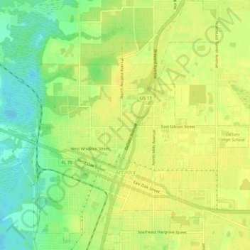
Nom : Carte topographique Arcadia, altitude, relief.
Lieu : Arcadia, DeSoto County, Florida, 34265, United States (27.20230 -81.87990 27.24557 -81.83451)
Altitude moyenne : 17 m
Altitude minimum : 2 m
Altitude maximum : 24 m
Autres cartes topographiques
Cliquez sur une carte pour visualiser sa topographie, son altitude et son relief.