
Carte topographique Loughton
Carte interactive
Cliquez sur la carte pour afficher l’altitude.
À propos de cette carte
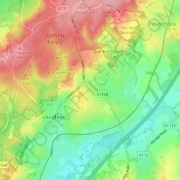
Nom : Carte topographique Loughton, altitude, relief.
Altitude moyenne : 58 m
Altitude minimum : 9 m
Altitude maximum : 116 m
Autres cartes topographiques
Cliquez sur une carte pour visualiser sa topographie, son altitude et son relief.
London Borough of Waltham Forest
United Kingdom > England > Essex > Epping Forest
London Borough of Waltham Forest, Epping Forest, Essex, Greater London, England, United Kingdom, Epping Forest
Altitude moyenne : 44 m