
Carte topographique Deorod
Carte interactive
Cliquez sur la carte pour afficher l’altitude.
À propos de cette carte
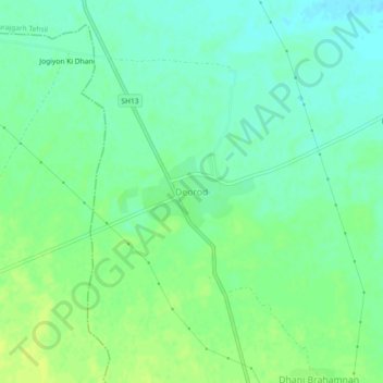
Nom : Carte topographique Deorod, altitude, relief.
Altitude moyenne : 303 m
Altitude minimum : 295 m
Altitude maximum : 310 m
Autres cartes topographiques
Cliquez sur une carte pour visualiser sa topographie, son altitude et son relief.
Dheendhwa Athoona
India > Rajasthan > Surajgarh Tehsil
Dheendhwa Athoona, Surajgarh Tehsil, Jhunjhunun District, Rajasthan, 333031, India
Altitude moyenne : 294 m
Pilani
India > Rajasthan > Surajgarh Tehsil
Pilani, Surajgarh Tehsil, Jhunjhunu District, Rajasthan, 333031, India
Altitude moyenne : 294 m