
Carte topographique Pinyon Pines
Carte interactive
Cliquez sur la carte pour afficher l’altitude.
Pinyon Pines
It is located in a small valley between the San Jacinto Mountains and Santa Rosa Mountains, north of State Route 74. It takes its name from the Pinyon pine (Pinus monophylla) trees native to the area. Pinyon Pines sits at an elevation of approximately 4000 feet.
À propos de cette carte
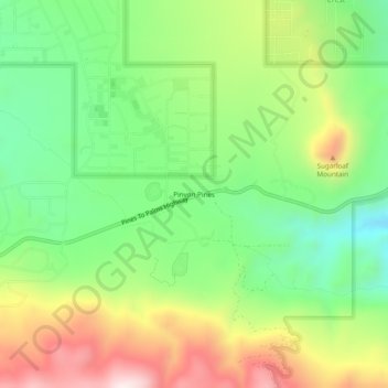
Nom : Carte topographique Pinyon Pines, altitude, relief.
Altitude moyenne : 1.276 m
Altitude minimum : 1.040 m
Altitude maximum : 1.621 m