
Carte topographique Strand
Carte interactive
Cliquez sur la carte pour afficher l’altitude.
À propos de cette carte
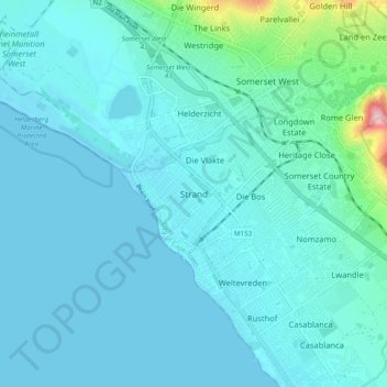
Nom : Carte topographique Strand, altitude, relief.
Lieu : Strand, City of Cape Town, Cap occidental, 7129, RSA (-34.14556 18.79056 -34.06556 18.87056)
Altitude moyenne : 22 m
Altitude minimum : 0 m
Altitude maximum : 204 m