
Carte topographique Rizal
Cliquez sur la carte pour afficher l’altitude.
Rizal
The Sinicking National Park has the height of 801 metres (2,628 ft) and the highest elevation between the town's Poblacion and barangay Gaddangao is 1,004 metres (3,294 ft). The entrance to the town is very similar to the Kennon Road of Baguio.
À propos de cette carte
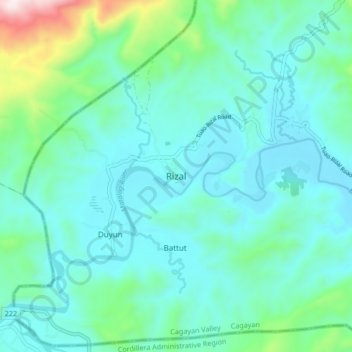
Nom : Carte topographique Rizal, altitude, relief.
Lieu : Rizal, Cagayan, Cagayan Valley, 3807, Philippines (17.80574 121.30572 17.88574 121.38572)
Altitude moyenne : 154 m
Altitude minimum : 30 m
Altitude maximum : 744 m
Autres cartes topographiques
Cliquez sur une carte pour visualiser sa topographie, son altitude et son relief.