
Carte topographique Elston
Cliquez sur la carte pour afficher l’altitude.
À propos de cette carte
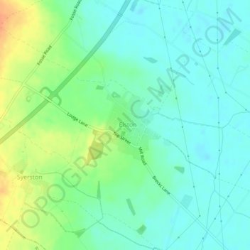
Nom : Carte topographique Elston, altitude, relief.
Altitude moyenne : 24 m
Altitude minimum : 11 m
Altitude maximum : 49 m
Autres cartes topographiques
Cliquez sur une carte pour visualiser sa topographie, son altitude et son relief.
Newark on Trent
United Kingdom > England > Nottinghamshire > Newark and Sherwood
Altitude moyenne : 18 m
Balderton
United Kingdom > England > Nottinghamshire > Newark and Sherwood > Balderton
Altitude moyenne : 20 m
Epperstone CP
United Kingdom > England > Nottinghamshire > Newark and Sherwood
The report notes Epperstone's "very distinctive character... a combination of topography, buildings, trees and walls.... The constantly changing views make it an attractive space to move through." It also notes, "The approach to the village from the west is along a tunnel formed by overhanging trees, including…
Altitude moyenne : 69 m
Danethorpe Hill
United Kingdom > England > Nottinghamshire > Newark and Sherwood
Altitude moyenne : 22 m
Bilsthorpe CP
United Kingdom > England > Nottinghamshire > Newark and Sherwood
Altitude moyenne : 75 m
Sutton-on-Trent CP
United Kingdom > England > Nottinghamshire > Newark and Sherwood
Altitude moyenne : 13 m
Farndon
United Kingdom > England > Nottinghamshire > Newark and Sherwood > Farndon
Altitude moyenne : 14 m
Staythorpe CP
United Kingdom > England > Nottinghamshire > Newark and Sherwood
The land is very low-lying and level, varying little in elevation between 12–14 metres (39–46 ft) throughout.
Altitude moyenne : 16 m
Blidworth Bottoms
United Kingdom > England > Nottinghamshire > Newark and Sherwood > Blidworth CP
Altitude moyenne : 107 m
Kelham CP
United Kingdom > England > Nottinghamshire > Newark and Sherwood > Newark on Trent
Altitude moyenne : 23 m
Collingham CP
United Kingdom > England > Nottinghamshire > Newark and Sherwood
Altitude moyenne : 15 m
Sherwood Forest National Nature Reserve
United Kingdom > England > Nottinghamshire > Newark and Sherwood > Ollerton
Altitude moyenne : 71 m
Goverton
United Kingdom > England > Nottinghamshire > Newark and Sherwood > Bleasby
Altitude moyenne : 34 m
North Muskham CP
United Kingdom > England > Nottinghamshire > Newark and Sherwood
Altitude moyenne : 11 m
Newark
United Kingdom > England > Nottinghamshire > Newark and Sherwood > Newark on Trent
Altitude moyenne : 17 m
Edwinstowe CP
United Kingdom > England > Nottinghamshire > Newark and Sherwood
Altitude moyenne : 68 m
South Scarle CP
United Kingdom > England > Nottinghamshire > Newark and Sherwood
Altitude moyenne : 11 m
Gunthorpe
United Kingdom > England > Nottinghamshire > Newark and Sherwood > Gunthorpe
Altitude moyenne : 23 m
Kirklington CP
United Kingdom > England > Nottinghamshire > Newark and Sherwood
Altitude moyenne : 61 m
Hoveringham
United Kingdom > England > Nottinghamshire > Newark and Sherwood > Hoveringham
Altitude moyenne : 30 m
Rainworth CP
United Kingdom > England > Nottinghamshire > Newark and Sherwood
Altitude moyenne : 111 m
Kings Clipstone
United Kingdom > England > Nottinghamshire > Newark and Sherwood
Altitude moyenne : 81 m
Blidworth CP
United Kingdom > England > Nottinghamshire > Newark and Sherwood
Altitude moyenne : 107 m
Carlton-on-Trent CP
United Kingdom > England > Nottinghamshire > Newark and Sherwood
Altitude moyenne : 12 m
Staythorpe CP
United Kingdom > England > Nottinghamshire > Newark and Sherwood
The land is very low-lying and level, varying little in elevation between 12–14 metres (39–46 ft) throughout.
Altitude moyenne : 16 m
Sutton-on-Trent CP
United Kingdom > England > Nottinghamshire > Newark and Sherwood
Altitude moyenne : 13 m
Hoveringham
United Kingdom > England > Nottinghamshire > Newark and Sherwood > Hoveringham
Altitude moyenne : 30 m
Newark
United Kingdom > England > Nottinghamshire > Newark and Sherwood > Newark on Trent
Altitude moyenne : 17 m