
Carte topographique Salur
Carte interactive
Cliquez sur la carte pour afficher l’altitude.
À propos de cette carte
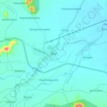
Nom : Carte topographique Salur, altitude, relief.
Lieu : Salur, Vizianagaram, Andhra Pradesh, 532591, India (18.47770 83.16810 18.55770 83.24810)
Altitude moyenne : 163 m
Altitude minimum : 132 m
Altitude maximum : 480 m
Salur is on the banks of River Vegavathi at 18°32′00″N 83°13′00″E / 18.5333°N 83.2167°E / 18.5333; 83.2167. It has an average elevation of 118 metres (387 ft). It is bounded by Makkuva, Bobbili, Ramabhadrapuram and Pachipenta mandals of Andhra Pradesh state. Salur is surrounded with green forests and chains of hills on two sides and by River Vegavathi on the other two.