Géolocaliser

Carte topographique Methipura

Carte interactive

Cliquez sur la carte pour afficher l’altitude.

À propos de cette carte

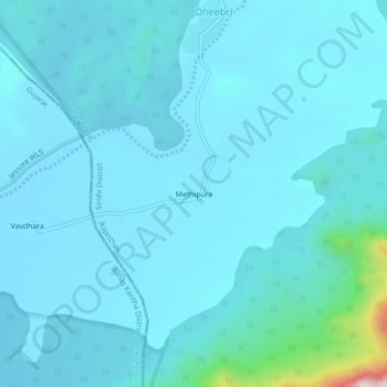
Nom : Carte topographique Methipura, altitude, relief.

Lieu : Methipura, Reodar Tehsil, Sirohi District, Rajasthan, India (24.41727 72.44363 24.45727 72.48363)

Altitude moyenne : 280 m

Altitude minimum : 230 m

Altitude maximum : 834 m

Autres cartes topographiques

Cliquez sur une carte pour visualiser sa topographie, son altitude et son relief.

Jolpur

India > Rajasthan > Reodar Tehsil > Jolpur

Jolpur, Reodar Tehsil, Sirohi, Rajasthan, India

Altitude moyenne : 281 m

Mohabbatgarh

India > Rajasthan > Reodar Tehsil > Mohabbatgarh

Mohabbatgarh, Reodar Tehsil, Sirohi, Rajasthan, India

Altitude moyenne : 283 m

Dantrai

India > Rajasthan > Reodar Tehsil

Dantrai, Reodar Tehsil, Sirohi District, Rajasthan, 307515, India

Altitude moyenne : 294 m