
Carte topographique Latehar
Carte interactive
Cliquez sur la carte pour afficher l’altitude.
À propos de cette carte
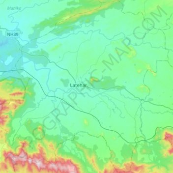
Nom : Carte topographique Latehar, altitude, relief.
Lieu : Latehar, Jharkhand, 829206, Inde (23.61506 84.37225 23.86932 84.64524)
Altitude moyenne : 452 m
Altitude minimum : 325 m
Altitude maximum : 1.015 m
Autres cartes topographiques
Cliquez sur une carte pour visualiser sa topographie, son altitude et son relief.