
Carte topographique Cuyo
Cliquez sur la carte pour afficher l’altitude.
Cuyo
Cuyo Island is the largest island of the Cuyo Archipelago, about 13 kilometers (8.1 mi) long, 7.5 kilometers (4.7 mi) wide, and with an area of 57 square kilometers (22 sq mi). Mount Bonbon with an elevation of 817 feet (249 m) is the highest mountain in Cuyo island. The Island is under the jurisdiction of the municipalities of Cuyo and Magsaysay. The poblacion of Cuyo is home to a Spanish fort, which shelters a church and a convent in its high stone walls.
À propos de cette carte
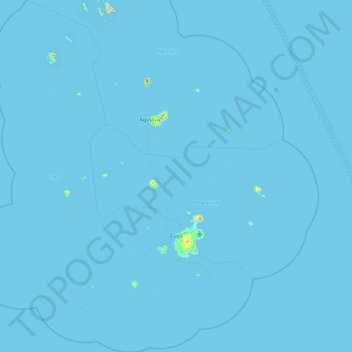
Nom : Carte topographique Cuyo, altitude, relief.
Lieu : Cuyo, Palawan, Mimaropa, 5318, Philippines (10.55793 120.47158 11.45374 121.20733)
Altitude moyenne : 0 m
Altitude minimum : -1 m
Altitude maximum : 246 m
Autres cartes topographiques
Cliquez sur une carte pour visualiser sa topographie, son altitude et son relief.
Likas Island
Philippines > Palawan > Kalayaan
West York Island, also known as Likas Island (Filipino: Pulo ng Likas, lit. 'Island of Naturality'; Mandarin Chinese: 西月島/西月岛; pinyin: Xīyuè Dǎo; Vietnamese: đảo Bến Lạc), and several other names. With an area of 18.6 hectares (46 acres), it is the third largest of the naturally…
Altitude moyenne : 0 m