
Faire un don
Équipez-vous pour votre prochaine aventure :
En tant que Partenaire Amazon, ce site perçoit une commission sur les achats éligibles sans surcoût pour vous.
Carte topographique Al Hajar Mountains
Cliquez sur la carte pour afficher l’altitude.
Faire un don
Équipez-vous pour votre prochaine aventure :
En tant que Partenaire Amazon, ce site perçoit une commission sur les achats éligibles sans surcoût pour vous.
Al Hajar Mountains
The high topography is around two major culminations: Jabal Akhdar and Saih Hatat, which are large scale anticlines. The Saih Hatat culmination contains eclogite in the northeast at As Sifah. These rocks were subducted to about 80 km (50 mi) depth into the mantle, and then exhumed back to the surface. This exhumation event created possibly the largest megasheath fold on Earth, the Wadi Mayh megasheath fold. The common view is that these eclogites were originally basic volcanic rocks within the leading edge of the continental crust of the Arabian Plate. This leading edge was then subducted by a NE-dipping subduction zone. However, some geologists have interpreted that these eclogites were subducted through a SW-dipping subduction zone.
Faire un don
Équipez-vous pour votre prochaine aventure :
En tant que Partenaire Amazon, ce site perçoit une commission sur les achats éligibles sans surcoût pour vous.
À propos de cette carte
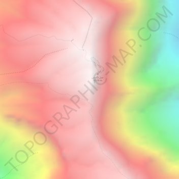
Nom : Carte topographique Al Hajar Mountains, altitude, relief.
Lieu : Al Hajar Mountains, Al Batinah South Governorate, Oman (23.23495 57.26245 23.23505 57.26255)
Altitude moyenne : 2.502 m
Altitude minimum : 1.454 m
Altitude maximum : 2.985 m
Faire un don
Équipez-vous pour votre prochaine aventure :
En tant que Partenaire Amazon, ce site perçoit une commission sur les achats éligibles sans surcoût pour vous.
Autres cartes topographiques
Cliquez sur une carte pour visualiser sa topographie, son altitude et son relief.