
Carte topographique Mahendragiri
Carte interactive
Cliquez sur la carte pour afficher l’altitude.
À propos de cette carte
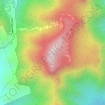
Nom : Carte topographique Mahendragiri, altitude, relief.
Altitude moyenne : 1.108 m
Altitude minimum : 711 m
Altitude maximum : 1.494 m
Mahendragiri, is a mountain in Rayagada block of the district of Gajapati, Odisha, India. It is situated amongst the Eastern Ghats at an elevation of 1,501 metres (4,925 ft).It is second biodiversity Heritage Site of Odisha. This is considered as one out of Seven Kula Parvat of India.
Autres cartes topographiques
Cliquez sur une carte pour visualiser sa topographie, son altitude et son relief.
Eastern Ghats
India > Odisha > Ramagiri > Burakhat
Eastern Ghats, Burakhat, Ramagiri, Gajapati District, Odisha, India
Altitude moyenne : 1.130 m